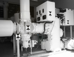
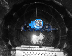
GIS (Gas Insulated Switchgear) infrastructure (interior/exterior) has been 3D scanned for As Built Documentation and BIM integration purposes.
Complete infrastructure 3D CAD model was created.
4 GIS situations on different location are included in our list of references.
Project was conducted with C&G Ljubljana company....
Read more
Kartiranje infrastrukture – Hidroelektrarna 1
For utility and surface infrastructure different technologies were used (laser scanning, classical surveying, aerial photogammetry, ground penetrating radar and utilities locator.
Read more
- UAV product: orthophoto 1cm/px map.
- TLS & Classical survey product: topo map, geolocation, 3D surface utility, terrain model.
- GPR and Detector products: Underground utility map.